1930s New York City Urban and Regional Planning
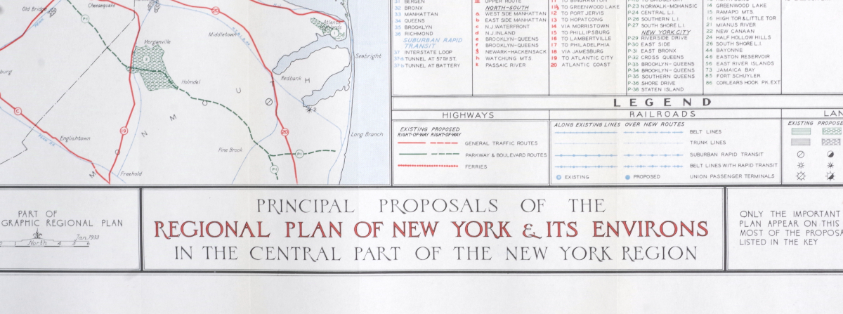
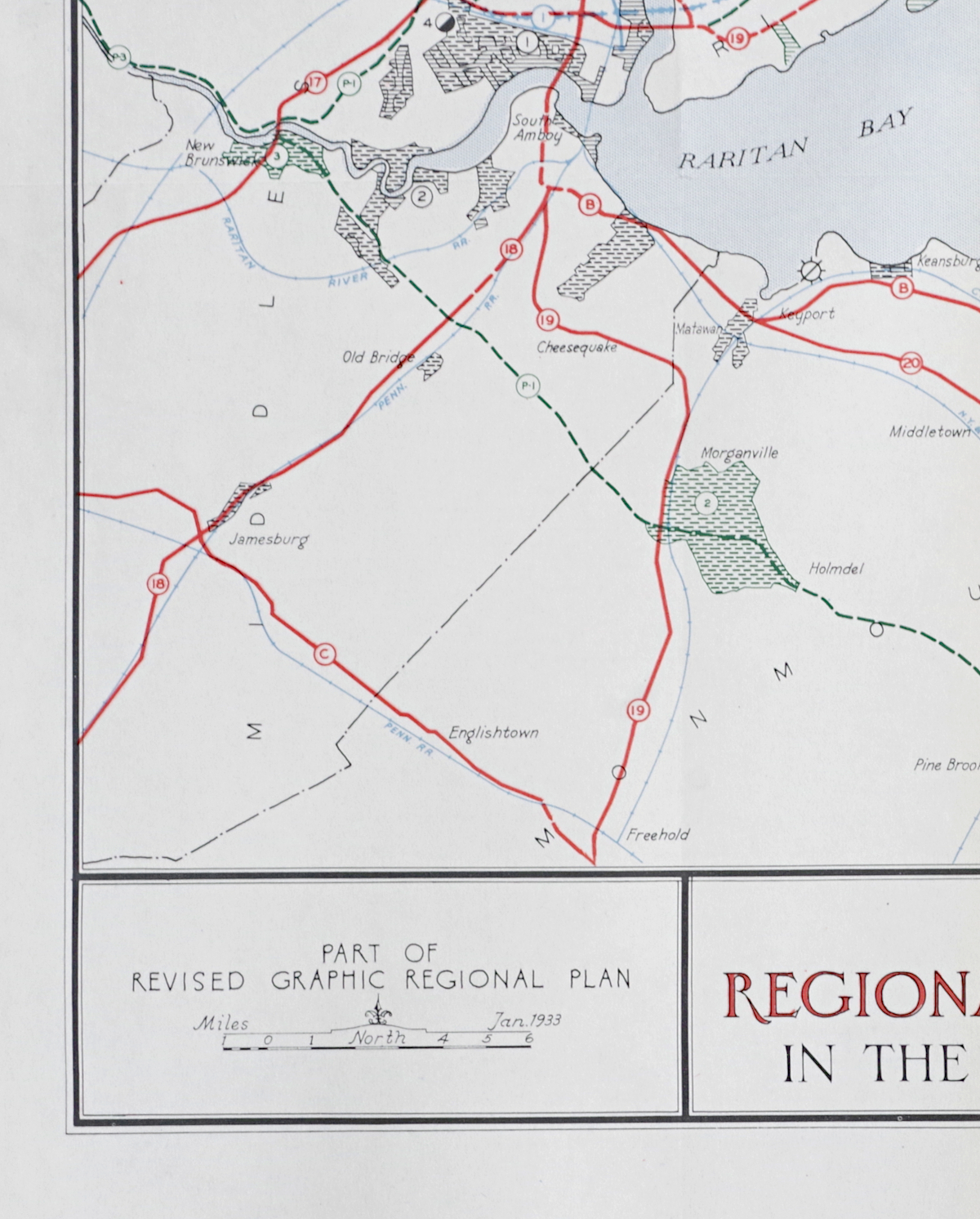
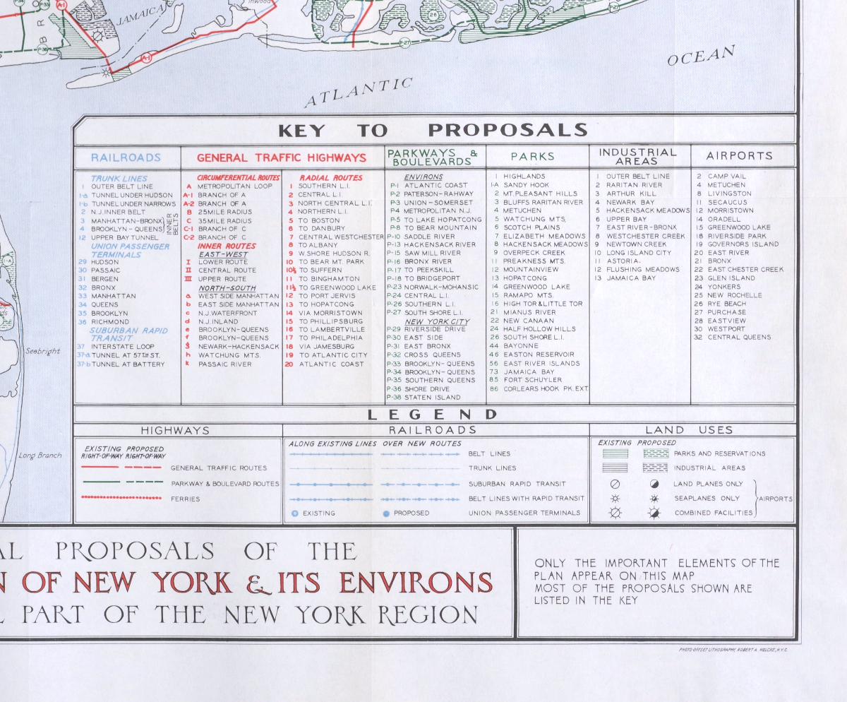
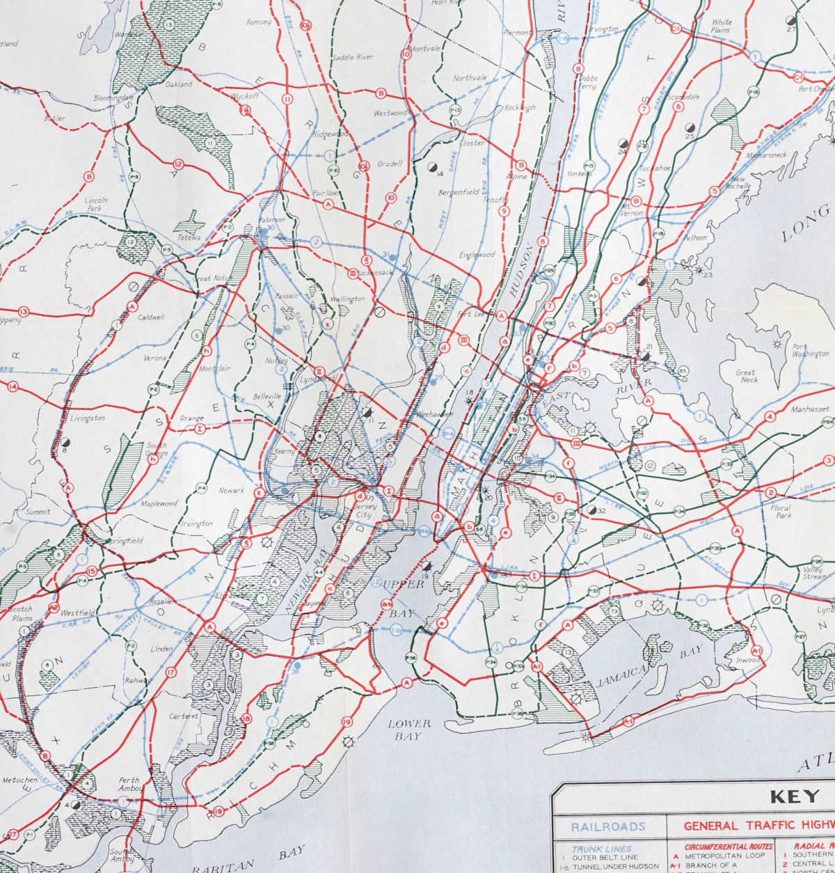
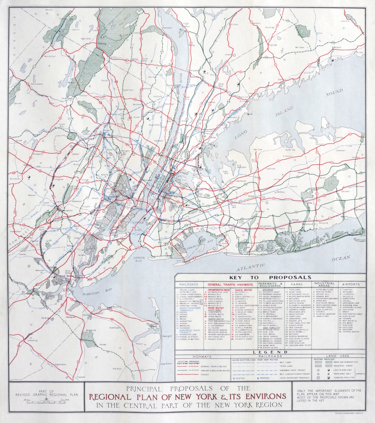
“Principal Proposals of the Regional Plan of New York & It's Environs in the Central Part of the New York Region”
Color offset lithograph map, 1933, dated lower-left, with an extensive key indicating all the proposals relating to railroads, highways, parkways, parks, industrial areas and airports, published by the Regional Plan of New York & It's Environs, and printed by Robert A. Welcke, New York; with horizontal and vertical folds as issued (now flattened), some very faint toning in a few areas (far less noticeable than it appears in the images) but otherwise in very good condition
SOLD
PURCHASING INFORMATION